GRANT ROAD COALITION - CENTRAL SEGMENTS
  • Home
  • MEMBERS
    • CONTACTS >
      • City
  • Docs
    • 2022.3 Safety Study
    • correspondence, minutes
    • UA Mountain Study 2022
    • GRIP
    • Park Aenue
    • Phase 2
    • Phase 5
  • FAQ
    • Bikes at Park and Mtn
    • Water Basin
    • Remnant Parcels
    • Phase 5
    • Noise Studies
  • PROJECTS
    • Health and Heritage Trail- Phase 1/2, Jefferson Park >
      • Banner Proposal-HH Trail
  • UNDERGROUND TEP

Phase II 

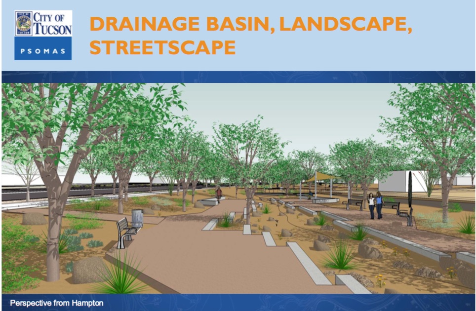
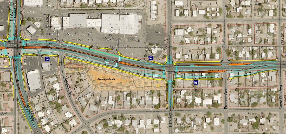
Phase II will go from Stone Ave to Park Ave. The design documents and more maps can be located on the city project site. To the right is a rendering of the basin on the south side of Grant Rd, starting at Hampton St. More maps can be found at the Grantroad.info website (linked bel0w).
Phase II - Click Here for More Info
Picture
Picture
City Owned property as of January 15, 2016 below
Picture
Proudly powered by Weebly
  • Home
  • MEMBERS
    • CONTACTS >
      • City
  • Docs
    • 2022.3 Safety Study
    • correspondence, minutes
    • UA Mountain Study 2022
    • GRIP
    • Park Aenue
    • Phase 2
    • Phase 5
  • FAQ
    • Bikes at Park and Mtn
    • Water Basin
    • Remnant Parcels
    • Phase 5
    • Noise Studies
  • PROJECTS
    • Health and Heritage Trail- Phase 1/2, Jefferson Park >
      • Banner Proposal-HH Trail
  • UNDERGROUND TEP